Dye Trace
When our divers reach a point within a cave or spring that is too narrow to swim, we have to use other tools to accomplish the task of figuring out where the water goes and how it moves. Dyes are often used to trace, or document, the path of water flow in fractured and porous systems, like karst. In addition to telling us where water is going, dye tracing is also useful in determining how surface activities on the soil and land affect the water below ground in the aquifer. Particularly in porous rock (like limestone, karst, etc.) where there is little time for filtration, this technique allows us to see how quickly pollutants can enter and move through our water systems.
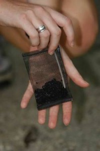
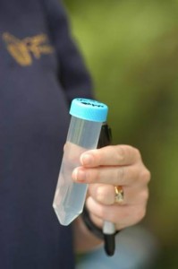
Once released into the water (or rock, soil, well, etc.), the dye mixes with the water and travels the same path that the water is flowing. At some point downstream, water samples are collected – either directly, or with the aid of charcoal sampling packets. The dye is adsorbed by pores in the activated charcoal and these can remain in situ for several hours/days/weeks. Dye in the charcoal packets must first be eluted (or de-sorbed) by washing it in a strong base/alcohol/water solution in order to analyze it.
The samples – both water and dye from eluted charcoal packets – are analyzed back at a laboratory using an instrument called a spectrofluorophotometer operated under a synchronous scan protocol to check for multiple sources of fluorescence.
The spectrofluorophotometer detects very small quantities of dye in solution by passing a light at one wavelength through the sample to excite the dye molecules, and then the dye molecules emit light at a longer wavelength. The spectrofluorophotometer measures the intensity of the emitted light and calculates the concentration of dye in the sample. There are many kinds of dyes used in hydrologic studies, and each one reflects a different wavelength…so it is possible to use more than one dye in each tracing event.
Hydrogeologists choose which dye to use based on a variety of factors including, but not limited to, the type of rock, site of planned introduction, amount of background organic material in the water/soil, pH, presence of soil, etc. Ultimately, these data give us information about the spatial (over distance) and temporal (over time) variability of water movement between surface and groundwaters. For this project, we used eosine dye, and samples were analyzed by Ozark Underground Laboratory. Both Karst Environmental Services and Ozark Underground Laboratory were consultants on this project.
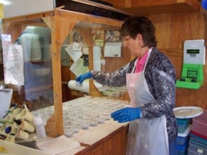
Activated charcoal samples being prepared for analysis at Ozark Underground Laboratory. Photo, courtesy Ozark Underground Laboratory


